Overview
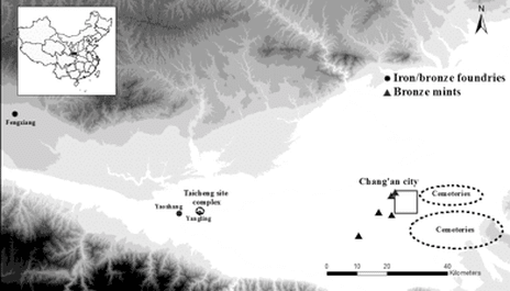
Xi’an, one of the oldest cities in China, has a history of more than 3,100 years. Thousands of years buried the civilization of this city, which was an economic and cultural center in ancient China. During Western Han, a dynasty two thousand years ago, there are many archeology sites around Xi’an. This study will investigate Taicheng site (Figure 1) and Yongcheng site, two Western Han sites around the modern-day Xi’an in China. We will apply multi-method geophysical investigations to these two sites. The information of these two archeology sites is presented in the following “Location and geology of the two archeology sites” part.
Location and geology of the two archeology sites*:
- Taicheng (Figure 1) is the name of a site complex that includes a Han cemetery (circa 202 BCE – 67 BCE), an iron foundry, and ash-pits associated with residential sites. The entire site complex is located in present-day Yangling city, about 70 minutes driving to the west of Xi’an. According to the historical records, the site complex itself might have been the town of the Taicheng in the Han period.
- Nangucheng is the name of a Western Han walled town, which is still preserved above ground today. Discovered in the very early of 1950’s and excavated two times afterward, the site is very close to the capital of the Qin state (one Chinese ancient country in 221 B.C.) named Yongcheng in the Spring-and-Autumn period (6-4th century BCE) in present day Baoji city. Also, a cast iron foundry was found during the excavation in the 1950’s and has yielded considerable numbers of casting moulds for casting agricultural tools similar to the assemblages from Taicheng.
|
|
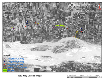
Figure 1. Satellite photos of Taicheng site.
According to the archeology investigation and the preliminary excavation results (Figure 2), there should be iron foundries under the two sites. Our object is to recover the two ancient iron foundries structures based on the multi-method geophysical investigation. Electromagnetic, magnetic and ground-penetrating radar (GPR) surveys were conducted on both the sites to obtain the 3D electronic conductivity and magnetic susceptibility maps. We plan to combine geophysical interpretations and archeology excavation findings to recover the two iron foundries in ancient China. In our field trip, we found some typical eaves tiles, tiles, bricks, and other utensils with the particular characteristics of Han Dynastic. However, because of the instrument issue, we only obtain the magnetic field intensity results (Figure 4) in Taicheng site. Strong magnetic anormaly was found in our results, which may be related to the iron foundries. The approval of our results need future excavation work.
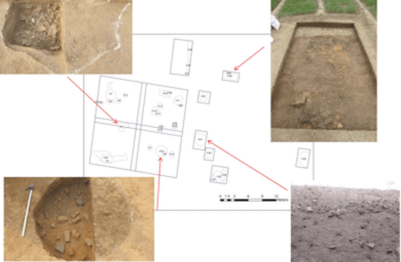
Figure 2. Map of excavated features at the Taicheng iron foundry
This project was an MIT IAP (winter vacation) project funded by Student Research Fund in the Dept. of EAPS, including two weeks of field work between Dec 22 and Jan 7 around Xi’an. The geophysical instruments would be rented from the local universities (Xi’an Jiao Tong University, etc.) in Xi’an. Data processing and interpretation have been done after the field work during the IAP, collaborating with graduate students in archeology at Harvard University.
|
|
|
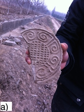
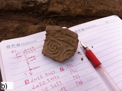
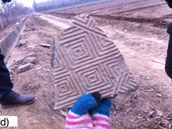
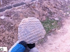
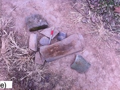
Figure 3. a) A typical eaves tile in Han Dynasty. b-e) Field trip notes and pieces of tiles and bricks in Han Dynasty.
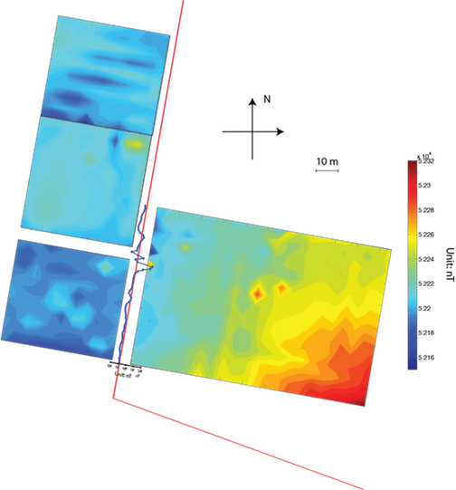
Figure 4. 2-D magnetic field intensity distribution. The red solid line denotes the walls in the site. The blue solid line along the wall is from the 1-D magnetic field intensity survey.
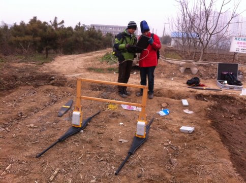
Figure 5. Undergrad students from Nanjing University and Xiamen University are working on the field GPR measurements
Reference
Thomas M. Urban, Douglas D. Anderson, and Wanni W. Anderson. Multimethod geophysical investigations at an Inupiaq village site in Kobuk Valley, Alaska. The Leading Edge, August 2012, v. 31, p. 950-956, doi:10.1190/tle31080950.1
Rainer Morawetz, Christoph Georg Eichkitz, Johannes Amtmann, and Hannes Heymans. Precise mapping using ground-penetrating radar of a Roman villa at Thalerhof Airport, Graz, Austria: Verification and modification of an excavation-based model. The Leading Edge, August 2012, v. 31, p. 922-927, doi:10.1190/tle31080922.1
Major Archaeological Discoveries in China in 2011. 2012, Beijing Cultural Relics Press.
